Information about property on 19 Rangeley Rd, Newton MA, 02465-1218. Find out owner contacts, building history, price, neighborhood at
Homemetry Address Directory.
Property Details
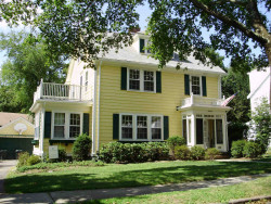
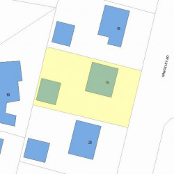
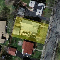
A single-family property at 19 Rangeley Road, Newton, Massachusetts.
Facts
Built in1928
Property useSingle Family
Lot size7,150 sqft
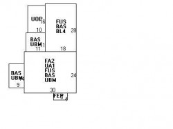
Effective area4,592 sqft
Gross building area5,798 sqft
Building typeResidential
Rooms9
Bedrooms4
Stories2
Exterior conditionGood
TrimNone
Foundation typeConcrete
Roof materialAsphalt Shingl
Fuel typeGas
Air conditioningCentral
Frontage65 feet
Finished attic area180 sqft
Basement area1,471 sqft
Finished basement area378 sqft
Porch area160 sqft
Enclosed porch area32 sqft
Detached garage area360 sqft
Heating & Cooling
Heat typeHot Wtr Radiat
Exterior Home Features
Exterior wallsClapboard
Roof typeGable
Features
Bath quality: Above Average
Interior condition: Average
Householders and Tenants for 19 Rangeley Rd, Newton MA
What year was the house at 19 Rangeley Rd, Newton, MA built?
The house at 19 Rangeley Rd, Newton, MA was built in 1928.
What type of house is at 19 Rangeley Rd, Newton, MA?
At the house at 19 Rangeley Rd, Newton, MA type Residence for Single Family.
Were there any reported FEMA incidents at 19 Rangeley Rd, Newton, MA?
The last FEMA incident recorded at 19 Rangeley Rd, Newton, MA was in 2003. Other FEMA incidents registered on Rangeley Rd are available at the link.
NOTICE: You may not use RadioAwards or the information it provides to make decisions about employment, credit, housing or any other purpose that would require Fair Credit Reporting Act (FCRA) compliance. RadioAwards is not a Consumer Reporting Agency (CRA) as defined by the FCRA and does not provide consumer reports.