Information about property on 9 Fordham Rd, Newton MA, 02465-1206. Find out owner contacts, building history, price, neighborhood at
Homemetry Address Directory.
Units
Property details of units in this apartment building
#11
6,622 sqft
6 beds
2 baths
Multi-Family Home
#2
Property Details
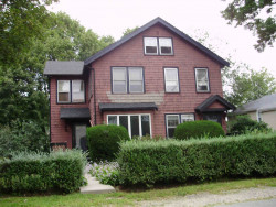
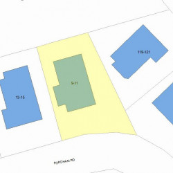
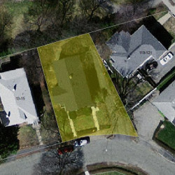
As is shown in our records this property is situated at 9 Fordham Road, Newton, MA.
Facts
Built in1925
Property useTwo Family
Lot size6,622 sqft
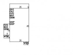
Effective area4,824 sqft
Gross building area6,578 sqft
Building typeResidential
Rooms12
Bedrooms6
Stories2
Exterior conditionGood
TrimNone
Foundation typeConcrete
Roof materialAsphalt Shingl
Fuel typeGas
Fireplaces1
Frontage68 feet
Finished attic area293 sqft
Basement area1,290 sqft
Porch area312 sqft
Deck area56 sqft
Heating & Cooling
Heat typeSteam
Exterior Home Features
Exterior wallsVinyl Siding
Roof typeGable
Features
Kitchen quality: Above Average
Bath quality: Average
Householders and Tenants for 9 Fordham Rd, Newton MA
What year was the house at 9 Fordham Rd, Newton, MA built?
The house at 9 Fordham Rd, Newton, MA was built in 1925.
What type of house is at 9 Fordham Rd, Newton, MA?
At the house at 9 Fordham Rd, Newton, MA type Two Family.
Were there any reported FEMA incidents at 9 Fordham Rd, Newton, MA?
The last FEMA incident recorded at 9 Fordham Rd, Newton, MA was in 2003. Other FEMA incidents registered on Fordham Rd are available at the link.
NOTICE: You may not use RadioAwards or the information it provides to make decisions about employment, credit, housing or any other purpose that would require Fair Credit Reporting Act (FCRA) compliance. RadioAwards is not a Consumer Reporting Agency (CRA) as defined by the FCRA and does not provide consumer reports.