83 Fordham Rd, Newton MA  02465-1208 exterior

83 Fordham Rd Newton, MA 02465 / 1208

Residence for Single Family

(UPDATED: 08/14/2025)
  • 4 Beds
  • 1 Baths
  • 4.712 square feet
Property Report

Information about property on 83 Fordham Rd, Newton MA, 02465-1208. Find out owner contacts, building history, price, neighborhood at Homemetry Address Directory.

Property Details

Constructed in 1940, this property has more than twenty-four hundred square feet of effective area and sits on 0,18 acres.

Facts

  • Built in 1940
  • Property use Single Family
  • Lot size 7,970 sqft
  • Effective area 2,444 sqft
  • Gross building area 4,712 sqft
  • Building type Residential
  • Rooms 8
  • Bedrooms 4
  • Stories 1,5
  • Exterior condition Average
  • Trim None
  • Foundation type Concrete
  • Roof material Asphalt Shingl
  • Fuel type Oil
  • Frontage 70 feet
  • Finished attic area 425 sqft
  • Unfinished attic area 213 sqft
  • Basement area 1,081 sqft
  • Finished basement area 281 sqft
  • Shed area 90 sqft
  • Basement garages 1
  • Heating & Cooling
  • Heat type Forced Air-Duc
  • Exterior Home Features
  • Exterior walls Aluminum Sidng
  • Roof type Gable

Householders and Tenants for 83 Fordham Rd, Newton MA

Possible residents contact details

Person Name Phone Number Additional Info
Allan B Goodrich Age: 82
617-965-****
Residential status:
Homeowner
Job:
Professional/Technical
Maria Goodrich
617-785-****
Residential status:
Homeowner
Job:
Sales Occupations
Mariateresa C Goodrich Age: 82
617-965-****
Residential status:
Homeowner
Job:
Retired
Peter A Goodrich Age: 49
617-965-****
Teresa C Goodrich Age: 83
617-965-****
Residential status:
Homeowner
Job:
Sales Occupations

Businesses

Organization Phone Number Additional Info
PHOTOGRAPHIC HISTORICAL SOCIETY OF NEW ENGLAND, INC
Type of Business:
Nonprofit Corporation
83 Fordham Rd, Newton MA  02465-1208 plot plan 83 Fordham Rd, Newton MA  02465-1208 floor plan 83 Fordham Rd, Newton MA  02465-1208 aerial view

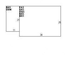
Cost estimate history

YearAssessment
2016 $480,400
2015 $449,000
2014 $427,200
2013 $427,200
2012 $427,200
2011 $438,300
2010 $447,200
2009 $456,300
2008 $456,300
2007 $445,700
2006$432,700
2005$412,100
2004$371,100
2003$331,300
2002$331,300
2001$282,700
2000$258,200
1999$234,900
1998$217,800
1997$206,400
1996$196,600
1995$162,600
1994$162,600
1993$162,600
1992$169,500

Where is 83 Fordham Rd, Newton MA located on map?

Building Permits

To date, we have no information about building permits in 2025
Jan 9, 2014
Description: Install standby generator on right side of house, which complies with setbacks
  • Valuation: $100,000
  • Fee: $18.60 paid to City of Newton, Massachusetts
  • Parcel #: 34022 0019
  • Permit #: 14010148

Fordham Rd Incidents registered in FEMA
(Federal Emergency Management Agency)

To date, we have no information about incidents registered in FEMA in 2025
28 Jan 2003 Fuel burner/boiler malfunction, fire confined
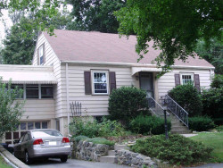
Property Use —
1 or 2 family dwelling
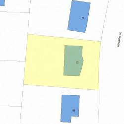
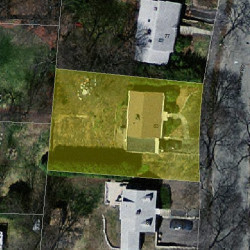
Properties Nearby

Street AddressResidens/Landlords
9 Fordham Rd, Newton, MA 02465-1206
Two Family
  • 6 beds
  • 6,578 sqft
  • Built in 1925
Edward E Asaley, Marilyn T Asaley
 

FAQ about the house at 83 Fordham Rd, Newton, MA


NOTICE: You may not use RadioAwards or the information it provides to make decisions about employment, credit, housing or any other purpose that would require Fair Credit Reporting Act (FCRA) compliance. RadioAwards is not a Consumer Reporting Agency (CRA) as defined by the FCRA and does not provide consumer reports.