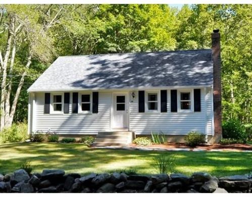
69 Charter Rd, Acton MA  01720-3001 exterior

69 Charter Rd Acton, MA 01720 / 3001

(UPDATED: 07/26/2025)
Sold Apr 2018
$551,000
Property Report

Information about property on 69 Charter Rd, Acton MA, 01720-3001. Find out owner contacts, building history, price, neighborhood at Homemetry Address Directory.

Property Details

As is shown in our records this property stands at 69 Charter Road, Acton, MA.

Facts

  • Built in 1952
  • Lot size 0,47 acres
  • Floor size 1,877 sqft
  • Rooms 7
  • Bedrooms 3
  • Stories 2
  • Structure type Cape cod
  • Heating & Cooling
  • Heat type Other
  • Exterior Home Features
  • Exterior material Vinyl
  • Roof type Asphalt

Listing info

  • Last sold Apr 2012 for $303,610

Householders and Tenants for 69 Charter Rd, Acton MA

Possible residents contact details

Person Name Phone Number Additional Info
Abraham J Raymond
Residential status:
Homeowner
Eileen P Doucette Apt # G
978-263-****
Residential status:
Homeowner
Job:
Administrative Support Occupations, Including Clerical Occupations
Karen C Fernandes Apt # 69
978-635-****
Nicholas S Dreckshage Age: 37
Thomas B Murtagh Age: 92

Units - Who lives at 69 Charter Rd, Acton MA

#69Karen C Fernandes 01720-3001
#GEileen P Doucette 01720-3001

Where is 69 Charter Rd, Acton MA located on map?

Market Activities

To date, we have no information about market activities in 2025
Apr 2018 Sold
69 Charter Rd
Price history :
  • 1,877
  • 3 beds
  • 2 baths

View more

Building Permits

To date, we have no information about building permits in 2025
Aug 17, 2012
  • Valuation: $1,175,000
  • Fee: $173.00 paid to Town of Acton, Massachusetts
  • Permit #: 12-0568

Charter Rd Fire Incident History

To date, we have no information about fire incidents in 2025
19 Nov 2018 Fire, other
Property Use —
High school/junior high school/middle school
Area of Origin —
Arena, assembly area w/ fixed seats - 100+ persons
First Ignition —
Electrical wire, cable insulation
Heat Source —
Hot or smoldering object, other
03 Jul 2012 Special outside fire, other
Property Use —
Elementary school, including kindergarten
Area of Origin —
Wildland, woods
First Ignition —
Organic materials, other
11 Aug 2011 Mobile property (vehicle) fire, other
Property Use —
Residential street, road or residential driveway
Area of Origin —
Highway, parking lot, street: on or near
Heat Source —
Spark, ember or flame from operating equipment
19 Jun 2010 Brush, or brush and grass mixture fire
Property Use —
Open land or field
Area of Origin —
Wildland, woods
First Ignition —
Heavy vegetation - not crop, including trees
Heat Source —
Hot or smoldering object, other

View more

Charter Rd Incidents registered in FEMA
(Federal Emergency Management Agency)

To date, we have no information about incidents registered in FEMA in 2025
31 Aug 2015 Power line down
Property Use —
High school/junior high school/middle school
19 May 2015 Power line down
Property Use —
Vehicle parking area
15 Mar 2014 Carbon monoxide incident
Property Use —
1 or 2 family dwelling
18 Feb 2014 Gas leak (natural gas or LPG)
Property Use —
High school/junior high school/middle school

View more

Properties Nearby

Street Address Residens/Landlords
 

FAQ about the house at 69 Charter Rd, Acton, MA


NOTICE: You may not use RadioAwards or the information it provides to make decisions about employment, credit, housing or any other purpose that would require Fair Credit Reporting Act (FCRA) compliance. RadioAwards is not a Consumer Reporting Agency (CRA) as defined by the FCRA and does not provide consumer reports.