483 Howard St Northborough, MA 01532 / 1032

Residence for Single Family

(UPDATED: 07/07/2025)
  • 3 Beds
  • 2 Baths
  • 3.85 acres
Sold Dec 2017
$370,000
Property Report

Information about property on 483 Howard St, Northborough MA, 01532-1032. Find out owner contacts, building history, price, neighborhood at Homemetry Address Directory.

Property Details

At 483 Howard Street, Northborough, Massachusetts stands a single-family colonial style property.

Facts

  • Built in 1979
  • Lot size 3,85 acres
  • Construction Concrete
  • Rooms 6
  • Bedrooms 3
  • Bathrooms 2
  • Stories 2 story with basement
  • Basement Basement (not specified)
  • Structure type Colonial
  • Heating & Cooling
  • Heat type Hot Water
  • Exterior Home Features
  • Exterior material Wood
  • Exterior walls Wood Siding

Listing info

  • Last sold Jun 1992 for $204,900

Features

  • Fireplace

Householders and Tenants for 483 Howard St, Northborough MA

Possible residents contact details

Person Name Phone Number Additional Info
Connie M Lunneborg Age: 67
701-471-****
Residential status:
Homeowner
Deirdre A Oconnor Age: 65
508-393-****
Residential status:
Homeowner
Michael Mackey
Peter E Chandler
Residential status:
Homeowner
Job:
Professional/Technical
Shawn C Lunneborg Age: 45
701-471-****
Residential status:
Homeowner

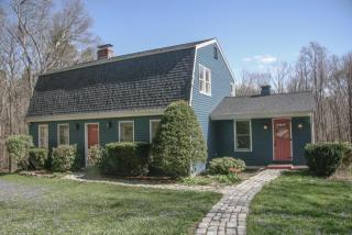
Cost estimate history

YearTaxAssessmentMarket
2014 $6,424 $387,200 N/A

Where is 483 Howard St, Northborough MA located on map?

Market Activities

To date, we have no information about market activities in 2025
Dec 2017 Sold
483 Howard St
Price history :
  • 2,049
  • 3 beds
  • 2 baths
May 2016 Sold
483 Howard St
Price history :
  • 2,049
  • 3 beds
  • 2 baths
Apr 2016 Sold
483 Howard St
Price history :
  • 2,049
  • 3 beds
  • 2 baths

View more

483 Howard St Fire Incident History

To date, we have no information about fire incidents in 2025
28 Apr 2012 Brush, or brush and grass mixture fire
Property Use —
Vacant lot
Area of Origin —
Wildland, woods
First Ignition —
Organic materials, other

Howard St Fire Incident History

To date, we have no information about fire incidents in 2025
23 May 2015 Brush, or brush and grass mixture fire
Property Use —
Open land or field
Area of Origin —
Wildland, woods
First Ignition —
Heavy vegetation - not crop, including trees
13 Jul 2014 Mobile property (vehicle) fire, other
Property Use —
Open land or field
Area of Origin —
Open area - outside; included are farmland, field
First Ignition —
Organic materials, other
Heat Source —
Hot or smoldering object, other
01 Dec 2013 Passenger vehicle fire
Property Use —
Residential street, road or residential driveway
Area of Origin —
Vehicle area, other
First Ignition —
Liquids, piping, filters, other
Heat Source —
Radiated, conducted heat from operating equipment
06 Jul 2013 Special outside fire, other
Property Use —
Open land or field
Area of Origin —
Outside area, other
First Ignition —
Atomized liquid, vaporized liquid, aerosol.
Heat Source —
Spark, ember or flame from operating equipment

View more

Howard St Incidents registered in FEMA
(Federal Emergency Management Agency)

To date, we have no information about incidents registered in FEMA in 2025
20 Sep 2015 Power line down
Property Use —
Outside or special property, other
23 May 2015 Forest, woods or wildland fire
Property Use —
Open land or field
04 Jul 2014 Power line down
Property Use —
Residential street, road or residential driveway
26 May 2013 Carbon monoxide incident
Property Use —
1 or 2 family dwelling

View more

Properties Nearby

Street AddressResidens/Landlords
 

FAQ about the house at 483 Howard St, Northborough, MA


NOTICE: You may not use RadioAwards or the information it provides to make decisions about employment, credit, housing or any other purpose that would require Fair Credit Reporting Act (FCRA) compliance. RadioAwards is not a Consumer Reporting Agency (CRA) as defined by the FCRA and does not provide consumer reports.