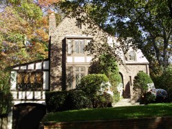
Information about property on 25 Burnside Rd, Newton MA, 02461-1401. Find out owner contacts, building history, price, neighborhood at
Homemetry Address Directory.
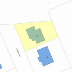
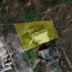
Property Details
This property with near twenty-seven hundred square feet of effective area on 0,12 acres was erected in the twenties.
Facts
Built in1927
Property useSingle Family
Lot size5,242 sqft
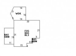
Effective area2,726 sqft
Gross building area3,134 sqft
Building typeResidential
Rooms6
Bedrooms3
Stories2
Exterior conditionAverage
TrimTwo Wall
Foundation typeConcrete
Roof materialAsphalt Shingl
Fuel typeGas
Air conditioningNone
Frontage75 feet
Basement area1,031 sqft
Finished basement area408 sqft
Deck area256 sqft
Basement garages1
Heating & Cooling
Heat typeHot Wtr Radiat
Exterior Home Features
Exterior wallsWood Shingle
Roof typeGable
Features
Kitchen quality: Below Average
Bath quality: Above Average
Householders and Tenants for 25 Burnside Rd, Newton MA
What year was the house at 25 Burnside Rd, Newton, MA built?
The house at 25 Burnside Rd, Newton, MA was built in 1927.
What type of house is at 25 Burnside Rd, Newton, MA?
At the house at 25 Burnside Rd, Newton, MA type Residence for Single Family.
NOTICE: You may not use RadioAwards or the information it provides to make decisions about employment, credit, housing or any other purpose that would require Fair Credit Reporting Act (FCRA) compliance. RadioAwards is not a Consumer Reporting Agency (CRA) as defined by the FCRA and does not provide consumer reports.