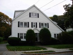
Cost estimate history
| Year | Assessment | ||
|---|---|---|---|
| 2016 | $771,400 | ||
| 2015 | $720,900 | ||
| 2014 | $688,900 | ||
| 2013 | $688,900 | ||
| 2012 | $688,900 | ||
| 2011 | $691,600 | ||
| 2010 | $705,700 | ||
| 2009 | $720,100 | ||
| 2008 | $720,100 | ||
| 2007 | $783,100 | ||
| 2006 | $760,300 | ||
| 2005 | $724,100 | ||
| 2004 | $663,200 | ||
| 2003 | $592,100 | ||
| 2002 | $592,100 | ||
| 2001 | $424,200 | ||
| 2000 | $387,400 | ||
| 1999 | $352,500 | ||
| 1998 | $362,700 | ||
| 1997 | $352,100 | ||
| 1996 | $335,300 | ||
| 1995 | $290,800 | ||
| 1994 | $290,800 | ||
| 1993 | $290,800 | ||
| 1992 | $347,100 |
Grant Ave Incidents registered in FEMA
(Federal Emergency Management Agency)
To date, we have no information about incidents registered in FEMA in 2025
30 Mar 2010
Gas leak (natural gas or LPG)
Property Use —
1 or 2 family dwelling
16 May 2004
Vehicle accident, general cleanup
Property Use —
Residential street, road or residential driveway
11 Dec 2003
Medical assist, assist EMS crew
Property Use —
1 or 2 family dwelling
28 Oct 2003
Heat from short circuit (wiring), defective/worn
Property Use —
Residential street, road or residential driveway
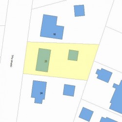
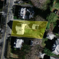
Properties Nearby
| Street Address | Residens/Landlords |
|---|