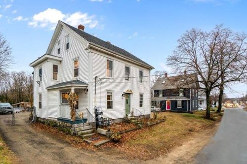
Market Activities
High St Fire Incident History
To date, we have no information about fire incidents in 2025
03 Oct 2019
Cooking fire, confined to container
Property Use —
Restaurant or cafeteria
Area of Origin —
Cooking area, kitchen
First Ignition —
Item First Ignited, Other
Heat Source —
Heat source: other
10 Jun 2019
Cooking fire, confined to container
Property Use —
1 or 2 family dwelling
Area of Origin —
Cooking area, kitchen
First Ignition —
Item First Ignited, Other
Heat Source —
Heat source: other
24 Apr 2019
Brush, or brush and grass mixture fire
Property Use —
Graded and cared-for plots of land
Area of Origin —
Open area - outside; included are farmland, field
First Ignition —
Light vegetation - not crop, including grass
Heat Source —
Hot ember or ash
21 Apr 2019
Cooking fire, confined to container
Property Use —
1 or 2 family dwelling
Area of Origin —
Cooking area, kitchen
First Ignition —
Item First Ignited, Other
Heat Source —
Heat source: other
118 High St incidents registered in FEMA
(Federal Emergency Management Agency)
To date, we have no information about incidents registered in FEMA in 2025
21 Aug 2006
Unauthorized burning
Property Use —
1 or 2 family dwelling
31 May 2003
EMS call, excluding vehicle accident with injury
Property Use —
Multifamily dwellings
24 Jan 2003
Water problem, other
Property Use —
Multifamily dwellings
08 Sep 2002
EMS call, excluding vehicle accident with injury
Property Use —
Multifamily dwellings
High St Incidents registered in FEMA
(Federal Emergency Management Agency)
To date, we have no information about incidents registered in FEMA in 2025
07 Nov 2015
Arcing, shorted electrical equipment
Property Use —
Eating, drinking places
07 Nov 2015
Vehicle accident, general cleanup
Property Use —
Residential street, road or residential driveway
03 Oct 2015
Arcing, shorted electrical equipment
Property Use —
Street, other
12 Sep 2015
Vehicle accident, general cleanup
Property Use —
Highway or divided highway
Properties Nearby
| Street Address | Residens/Landlords | |
|---|---|---|
12 High St, Ipswich, MA 01938-1918 Single Family
|
AMERICANS FOR CAMPAIGN ETHICS, INC, Illustration | |
112 High St, Ipswich, MA 01938-1245 Multiple Occupancy
|
Catherine G Hovey, Cathy Hovey | |
114 High St, Ipswich, MA 01938-1245 Single Family
|
Melissa P Reidy, Melissa P Walsh | |
115 High St, Ipswich, MA 01938-1237 Single Family
|
Baker Sutton House, Vosh International | |
116 High St, Ipswich, MA 01938-1245 Multiple Occupancy
|
Steven B Maynard, Michael J Nugent | |
117 High St, Ipswich, MA 01938-1236 High Rise |
Bradford Rainville Enterprises, Brittnie Aiello | |
120 High St, Ipswich, MA 01938-1245 Single Family
|
Security Pest Elimination, Alexandra Gauthier | |
121 High St, Ipswich, MA 01938-1237 Single Family
|
Mellisa A Greeley, Paul C Ramsdell | |
122 High St, Ipswich, MA 01938-1245 Single Family
|
Candi L Stone, Dexter E Stone | |
123 High St, Ipswich, MA 01938-1261 Condominium (Residential)
|
Brian H Chalifour, Adam H Hanson |

