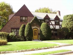
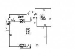
Cost estimate history
| Year | Assessment | ||
|---|---|---|---|
| 2016 | $1,159,100 | ||
| 2015 | $1,083,300 | ||
| 2014 | $1,038,700 | ||
| 2013 | $1,038,700 | ||
| 2012 | $1,038,700 | ||
| 2011 | $1,045,100 | ||
| 2010 | $1,066,400 | ||
| 2009 | $1,088,200 | ||
| 2008 | $1,088,200 | ||
| 2007 | $1,113,000 | ||
| 2006 | $1,080,600 | ||
| 2005 | $942,400 | ||
| 2004 | $819,100 | ||
| 2003 | $731,300 | ||
| 2002 | $731,300 | ||
| 2001 | $615,200 | ||
| 2000 | $561,800 | ||
| 1999 | $480,900 | ||
| 1998 | $420,200 | ||
| 1997 | $412,000 | ||
| 1996 | $392,400 | ||
| 1995 | $367,800 | ||
| 1994 | $343,700 | ||
| 1993 | $343,700 | ||
| 1992 | $359,700 |
Cotton St Incidents registered in FEMA
(Federal Emergency Management Agency)
To date, we have no information about incidents registered in FEMA in 2025
29 Oct 2011
Arcing, shorted electrical equipment
Property Use —
Residential street, road or residential driveway
17 May 2008
Electrical wiring/equipment problem, other
Property Use —
1 or 2 family dwelling
11 Apr 2008
Gas leak (natural gas or LPG)
Property Use —
1 or 2 family dwelling
02 Jul 2007
Electrical wiring/equipment problem, other
Property Use —
1 or 2 family dwelling
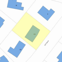
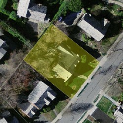
Properties Nearby
| Street Address | Residens/Landlords | |
|---|---|---|
12 Cotton St, Newton, MA 02458-2620 Single Family
|
Alice T Shaw, Stanley Y Shaw | |
15 Cotton St, Newton, MA 02458-2619 Single Family
|
Elizabeth B Karten, Harvey J Karten |