Cost estimate history
| Year | Tax | Assessment | Market |
|---|---|---|---|
| 2013 | $41,566 | $3,214,700 | N/A |
Market Activities
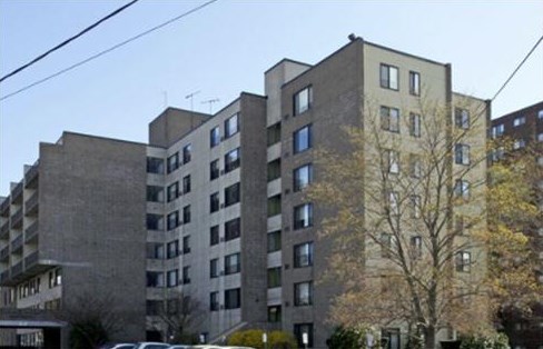
109 Broad St Fire Incident History
To date, we have no information about fire incidents in 2025
13 Aug 2017
Passenger vehicle fire
Property Use —
Residential street, road or residential driveway
Area of Origin —
Engine area, running gear, wheel area
First Ignition —
Item First Ignited, Other
25 Dec 2013
Cooking fire, confined to container
Property Use —
Multifamily dwellings
Area of Origin —
Cooking area, kitchen
First Ignition —
Cooking materials, including edible materials
Heat Source —
Heat source: other
06 Jun 2009
Natural vegetation fire, other
Property Use —
Vacant lot
Area of Origin —
Outside area, other
First Ignition —
Organic materials, other
Heat Source —
Cigarette
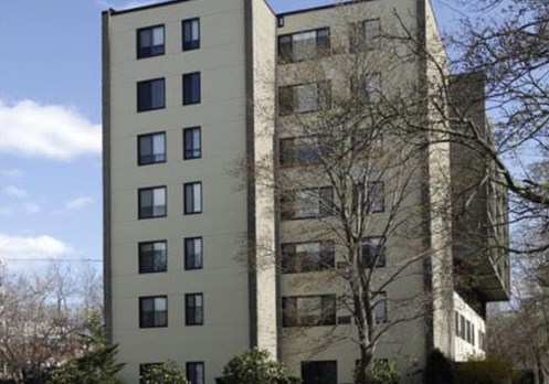
Broad St Fire Incident History
To date, we have no information about fire incidents in 2025
22 Aug 2019
Cooking fire, confined to container
Property Use —
Multifamily dwellings
Area of Origin —
Cooking area, kitchen
First Ignition —
Item First Ignited, Other
Heat Source —
Heat from undetermined smoking material
19 Aug 2019
Natural vegetation fire, other
Property Use —
Bank
28 Nov 2018
Passenger vehicle fire
Property Use —
Residential street, road or residential driveway
Area of Origin —
Cargo/trunk area - all vehicles
21 Nov 2018
Passenger vehicle fire
Property Use —
Residential street, road or residential driveway
Area of Origin —
Engine area, running gear, wheel area
109 Broad St incidents registered in FEMA
(Federal Emergency Management Agency)
To date, we have no information about incidents registered in FEMA in 2025
09 Jan 2013
Cooking fire, confined to container
Property Use —
Multifamily dwellings
09 Dec 2012
Cooking fire, confined to container
Property Use —
Multifamily dwellings
09 Dec 2012
Cooking fire, confined to container
Property Use —
Multifamily dwellings
15 Sep 2012
Cooking fire, confined to container
Property Use —
Multifamily dwellings
Broad St Incidents registered in FEMA
(Federal Emergency Management Agency)
To date, we have no information about incidents registered in FEMA in 2025
29 Nov 2015
Vehicle accident, general cleanup
Property Use —
Ice rink: indoor, outdoor
27 Nov 2015
Carbon monoxide incident
Property Use —
Multifamily dwellings
23 Nov 2015
Vehicle accident, general cleanup
Property Use —
Street or road in commercial area
18 Nov 2015
Gasoline or other flammable liquid spill
Property Use —
Multifamily dwellings
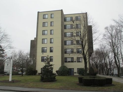
Properties Nearby
| Street Address | Residens/Landlords | |
|---|---|---|
11 Broad St, Weymouth, MA 02188-1705 Single Family
|
Katy S Bennett, Charlette M Preslar | |
100 Broad St, Weymouth, MA 02188-2314 Single Family
|
Amcomm Solutions LLC, AMERICAN COMMUNICATIONS SYSTEMS, INC | |
106 Broad St, Weymouth, MA 02188-2338 Multi-Family Home
|
Marlyne Alphonse, Jacqueline Anderson | |
110 Broad St, Weymouth, MA 02188-2314 Single Family
|
Francis C Brogna, Anne M Hashem | |
114 Broad St, Weymouth, MA 02188-2314 Single Family Residential
|
Dung A Ninh, Jessica Ninh | |
128 Broad St, Weymouth, MA 02188-2337 Single Family
|
Timothy J Bailey | |
| S Brown, Beverly A Dahlbo | ||
141 Broad St, Weymouth, MA 02188-2336 Single Family
|
KNICKERBOCKER ENTERPRISES, INC |