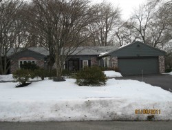
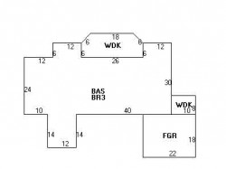

Cost estimate history
| Year | Assessment | ||
|---|---|---|---|
| 2016 | $977,300 | ||
| 2015 | $913,400 | ||
| 2014 | $874,200 | ||
| 2013 | $874,200 | ||
| 2012 | $874,200 | ||
| 2011 | $882,800 | ||
| 2010 | $900,800 | ||
| 2009 | $919,200 | ||
| 2008 | $919,200 | ||
| 2007 | $939,000 | ||
| 2006 | $983,600 | ||
| 2005 | $936,800 | ||
| 2004 | $870,100 | ||
| 2003 | $776,900 | ||
| 2002 | $776,900 | ||
| 2001 | $662,800 | ||
| 2000 | $605,300 | ||
| 1999 | $550,900 | ||
| 1998 | $465,800 | ||
| 1997 | $465,800 | ||
| 1996 | $443,600 | ||
| 1995 | $363,100 | ||
| 1994 | $345,800 | ||
| 1993 | $345,800 | ||
| 1992 | $373,500 |
Levbert Rd Incidents registered in FEMA
(Federal Emergency Management Agency)
To date, we have no information about incidents registered in FEMA in 2025
02 Apr 2008
Hazardous condition, other
Property Use —
1 or 2 family dwelling
07 Oct 2003
Medical assist, assist EMS crew
Property Use —
1 or 2 family dwelling
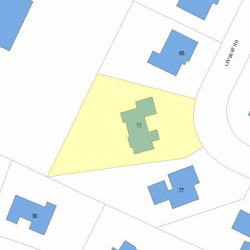
Properties Nearby
| Street Address | Residens/Landlords |
|---|