47 Harland St Milton, MA 02186 / 3624

Residence for Single Family

(UPDATED: 07/08/2025)
  • 4 Beds
  • 2 Baths
  • 2.864 square feet
Sold Dec 2017
$822,000
Property Report

Information about property on 47 Harland St, Milton MA, 02186-3624. Find out owner contacts, building history, price, neighborhood at Homemetry Address Directory.

Property Details

A hefty single-family estate at 47 Harland Street, Milton, MA.

Facts

  • Built in 1961
  • Lot size 0,48 acres
  • Floor size 2,864 sqft
  • Construction Frame
  • Rooms 8
  • Bedrooms 4
  • Basement Unfinished Basement
  • Heating & Cooling
  • Heat type Forced air unit
  • Exterior Home Features
  • Exterior material Wood
  • Exterior walls Wood Siding
  • Roof type Asphalt
  • Parking & Garage
  • Parking Underground/Basement
  • Parking spaces 2

Listing info

  • Last sold Sep 2014 for $699,000

Features

  • Fireplace
  • A/C

Householders and Tenants for 47 Harland St, Milton MA

Possible residents contact details

Person Name Phone Number Additional Info
Edwin J Riley
617-698-****
Residential status:
Homeowner
Job:
Medical Professional
James P Riley Age: 48
617-698-****
Marguerit Riley Age: 77
Residential status:
Homeowner
Job:
Administrative Support Occupations, Including Clerical Occupations
Marguerite M Riley Age: 88
617-698-****

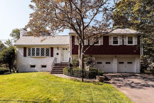
Cost estimate history

YearTaxAssessmentMarket
2013 $6,509 $442,800 N/A

Where is 47 Harland St, Milton MA located on map?

Market Activities

To date, we have no information about market activities in 2025
Dec 2017 Sold
47 Harland St
Price history :
  • 1,784
  • 4 beds
  • 4 baths
Oct 2017 Sold
47 Harland St
Price history :
  • 2,864
  • 3 beds
  • 4 baths

View more

Harland St Fire Incident History

To date, we have no information about fire incidents in 2025
04 May 2014 Brush, or brush and grass mixture fire
Property Use —
Open land or field
Area of Origin —
Outside area, other
First Ignition —
Agricultural crop, including fruits and vegetables
Heat Source —
Hot ember or ash
31 Jul 2013 Mobile property (vehicle) fire, other
Property Use —
Open land or field
Area of Origin —
Vehicle area, other
30 May 2009 Mobile property (vehicle) fire, other
Property Use —
Residential street, road or residential driveway
Area of Origin —
Engine area, running gear, wheel area
First Ignition —
Electrical wire, cable insulation
28 Mar 2009 Special outside fire, other
Property Use —
Graded and cared-for plots of land
Area of Origin —
Outside area, other
First Ignition —
Organic materials, other

View more

Harland St Incidents registered in FEMA
(Federal Emergency Management Agency)

To date, we have no information about incidents registered in FEMA in 2025
21 Feb 2015 Carbon monoxide incident
Property Use —
1 or 2 family dwelling
06 Feb 2013 Carbon monoxide incident
Property Use —
1 or 2 family dwelling
03 Jun 2012 Cooking fire, confined to container
Property Use —
1 or 2 family dwelling
12 Jun 2008 Accident, potential accident, other
Property Use —
Residential street, road or residential driveway

View more

Properties Nearby

Street AddressResidens/Landlords
28 Harland St, Milton, MA 02186-3625
Single Family Residential
  • 3 beds
  • 2 baths
  • Lot: 0.91 acres
  • Built in 2001
Clare F Keating, Kevin G Keating
31 Harland St, Milton, MA 02186-3624
Single Family Residential
  • 4 beds
  • 2 baths
  • Lot: 0.58 acres
  • Built in 1961
Jas P Mc Gettrick, Kenneth J Klapman
39 Harland St, Milton, MA 02186-3624
Single Family Residential
  • 3 beds
  • 2 baths
  • Lot: 0.53 acres
  • Built in 1963
LORNE, CORP, Brian L Bennett
 

FAQ about the house at 47 Harland St, Milton, MA


NOTICE: You may not use RadioAwards or the information it provides to make decisions about employment, credit, housing or any other purpose that would require Fair Credit Reporting Act (FCRA) compliance. RadioAwards is not a Consumer Reporting Agency (CRA) as defined by the FCRA and does not provide consumer reports.