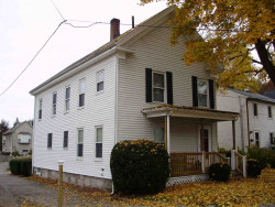
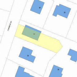
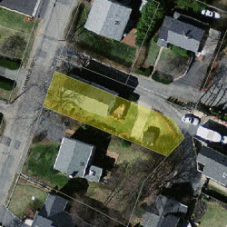
Information about property on 34 Cummings Rd, Newton MA, 02459-1753. Find out owner contacts, building history, price, neighborhood at
Homemetry Address Directory.
Property Details
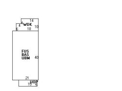
This property with near twenty-eight hundred square feet of effective area on 0,1 acres was originally built in 1920.
Facts
Built in1920
Property useSingle Family
Lot size4,170 sqft
Effective area2,759 sqft
Building typeResidential
Rooms6
Bedrooms3
Bathrooms1
Stories2
Exterior conditionAverage
TrimNone
Foundation typeBrick/Fldstone
Roof materialAsphalt Shingl
Fuel typeOil
Frontage30 feet
Basement area840 sqft
Shed area64 sqft
Porch area75 sqft
Deck area164 sqft
Heating & Cooling
Heat typeHot Wtr Radiat
Exterior Home Features
Exterior wallsVinyl Siding
Roof typeGable
Householders and Tenants for 34 Cummings Rd, Newton MA
What year was the house at 34 Cummings Rd, Newton, MA built?
The house at 34 Cummings Rd, Newton, MA was built in 1920.
What type of house is at 34 Cummings Rd, Newton, MA?
At the house at 34 Cummings Rd, Newton, MA type Residence for Single Family.
Were there any reported FEMA incidents at 34 Cummings Rd, Newton, MA?
The last FEMA incident recorded at 34 Cummings Rd, Newton, MA was in 2003. Other FEMA incidents registered on Cummings Rd are available at the link.
NOTICE: You may not use RadioAwards or the information it provides to make decisions about employment, credit, housing or any other purpose that would require Fair Credit Reporting Act (FCRA) compliance. RadioAwards is not a Consumer Reporting Agency (CRA) as defined by the FCRA and does not provide consumer reports.