Cost estimate history
| Year | Assessment | ||
|---|---|---|---|
| 2016 | $591,300 | ||
| 2015 | $552,600 | ||
| 2014 | $530,700 | ||
| 2013 | $530,700 | ||
| 2012 | $530,700 | ||
| 2011 | $539,500 | ||
| 2010 | $550,500 | ||
| 2009 | $579,500 | ||
| 2008 | $579,500 | ||
| 2007 | $593,400 | ||
| 2006 | $576,100 | ||
| 2005 | $559,300 | ||
| 2004 | $477,300 | ||
| 2003 | $418,700 | ||
| 2002 | $418,700 | ||
| 2001 | $351,700 | ||
| 2000 | $321,200 | ||
| 1999 | $292,300 | ||
| 1998 | $259,700 | ||
| 1997 | $259,700 | ||
| 1996 | $247,300 | ||
| 1995 | $232,500 | ||
| 1994 | $239,700 | ||
| 1993 | $239,700 | ||
| 1992 | $257,000 |
Auburndale Ave Fire Incident History
To date, we have no information about fire incidents in 2025
30 Mar 2011
Building fires
Property Use —
Multifamily dwellings
Area of Origin —
Vehicle area, other
First Ignition —
Multiple items first ignited
18 Aug 2008
Building fires
Property Use —
1 or 2 family dwelling
Area of Origin —
Exterior balcony, unenclosed porch
01 Aug 2002
Fires in structures other than in a building
Property Use —
Graded and cared-for plots of land
Area of Origin —
Courtyard, patio, porch, terrace
First Ignition —
Organic materials, other
Heat Source —
Heat from undetermined smoking material
Auburndale Ave Incidents registered in FEMA
(Federal Emergency Management Agency)
To date, we have no information about incidents registered in FEMA in 2025
11 Jul 2010
Electrical wiring/equipment problem, other
Property Use —
Pipeline, power line or other utility right of way
21 Dec 2008
Arcing, shorted electrical equipment
Property Use —
Residential street, road or residential driveway
16 Jul 2007
Vehicle accident, general cleanup
Property Use —
Residential street, road or residential driveway
18 Mar 2007
Carbon monoxide incident
Property Use —
1 or 2 family dwelling
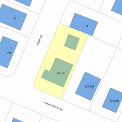
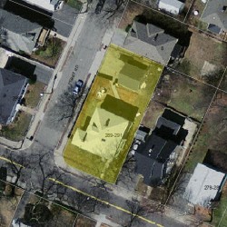
Properties Nearby
| Street Address | Residens/Landlords | |
|---|---|---|
| Betty Destefano | ||
| Dawn Pequeneza, Gabriel J Pequeneza | ||
| Dawn Dexter, John P Fantini | ||
| Vanessa C Lever | ||
279 Auburndale Ave, Newton, MA 02466-1603 Two Family
|
Aisha D Atkins, Nathaniel Atkins | |
281 Auburndale Ave, Newton, MA 02466-1603 Two Family
|
Richard J Daley, Ann M Ide | |
283 Auburndale Ave, Newton, MA 02466-1603 Two Family
|
Charles J Albanese, Christopher J Annantuonio | |
285 Auburndale Ave, Newton, MA 02466-1603 Two Family
|
John V Downie Architect, Sunny Window | |
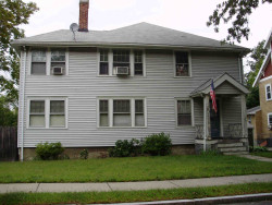
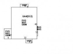
289 Auburndale Ave, Newton, MA 02466-1603 Two Family
|
Sara A Macbride, Richard M Macbride |