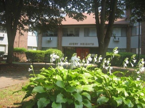
Cost estimate history
| Year | Tax | Assessment | Market |
|---|---|---|---|
| 2014 | $115,467 | $4,627,560 | N/A |
Market Activities
300 Brandegee Ave Fire Incident History
To date, we have no information about fire incidents in 2024
23 Apr 2018
Natural vegetation fire, other
Property Use —
Multifamily dwellings
Area of Origin —
Outside area, other
First Ignition —
Organic materials, other
Heat Source —
Cigarette
24 Dec 2016
Mobile property (vehicle) fire, other
Property Use —
Vehicle parking area
Area of Origin —
Engine area, running gear, wheel area
First Ignition —
Electrical wire, cable insulation
Heat Source —
Arcing
27 Aug 2015
Fire, other
Property Use —
Multifamily dwellings
Area of Origin —
Cooking area, kitchen
First Ignition —
Cooking materials, including edible materials
Heat Source —
Hot or smoldering object, other
02 Dec 2011
Building fires
Property Use —
Multifamily dwellings
Area of Origin —
Bedroom - < 5 persons; included are jail or prison
First Ignition —
Book
Heat Source —
Candle
Brandegee Ave Fire Incident History
To date, we have no information about fire incidents in 2024
28 Jun 2019
Brush, or brush and grass mixture fire
Property Use —
1 or 2 family dwelling
Area of Origin —
Open area - outside; included are farmland, field
First Ignition —
Light vegetation - not crop, including grass
Heat Source —
Match
23 Apr 2018
Natural vegetation fire, other
Property Use —
Multifamily dwellings
Area of Origin —
Outside area, other
First Ignition —
Organic materials, other
Heat Source —
Cigarette
24 Dec 2016
Mobile property (vehicle) fire, other
Property Use —
Vehicle parking area
Area of Origin —
Engine area, running gear, wheel area
First Ignition —
Electrical wire, cable insulation
Heat Source —
Arcing
09 Jun 2016
Brush, or brush and grass mixture fire
Property Use —
Residential street, road or residential driveway
Area of Origin —
Highway, parking lot, street: on or near
First Ignition —
Light vegetation - not crop, including grass
Heat Source —
Arcing
300 Brandegee Ave incidents registered in FEMA
(Federal Emergency Management Agency)
To date, we have no information about incidents registered in FEMA in 2024
16 May 2015
Cooking fire, confined to container
Property Use —
Multifamily dwellings
25 Apr 2015
Cooking fire, confined to container
Property Use —
Multifamily dwellings
11 Jul 2014
Gasoline or other flammable liquid spill
Property Use —
Multifamily dwellings
13 Feb 2014
Cooking fire, confined to container
Property Use —
Multifamily dwellings
Brandegee Ave Incidents registered in FEMA
(Federal Emergency Management Agency)
To date, we have no information about incidents registered in FEMA in 2024
16 May 2015
Cooking fire, confined to container
Property Use —
Multifamily dwellings
25 Apr 2015
Cooking fire, confined to container
Property Use —
Multifamily dwellings
26 Aug 2014
Gas leak (natural gas or LPG)
Property Use —
High school/junior high school/middle school
11 Jul 2014
Gasoline or other flammable liquid spill
Property Use —
Multifamily dwellings
Properties Nearby
| Street Address | Residens/Landlords | |
|---|---|---|
58 Brandegee Ave, Groton, CT 06340-4504 Multi-Family Home
|
Ella L Boland, Matthew S Boland |
Schools near property
| Name | Type | Grade | Distance |
|---|---|---|---|
| Elementary school | |||
| Catherine Kolnaski Magnet School 500 Poquonnock Rd, Groton, CT 06340 860-449-5612 | Public | K-5 | 0.48 |
| Claude Chester School One Harry Day Rd, Groton, CT 06340 860-449-5636 | Public | PK-5 | 2.17 |
| Middle school | |||
| West Side Middle School 250 Brandegee Ave, Groton, CT 06340 860-449-5630 | Public | 6-8 | 0.12 |
| Fitch Middle School 61 Fort Hill Rd, Groton, CT 06340 860-449-5620 | Public | 6-8 | 1.88 |
| High school | |||
| Ella T. Grasso Southeastern Technical High School 189 Fort Hill Rd, Groton, CT 06340 860-448-0220 | Public | 9-12 | 1.95 |
| Stedfast Christian Academy 1041 Poquonnock Rd, Groton, CT 06340 860-449-8526 | Private | PK-12 | 1.95 |


