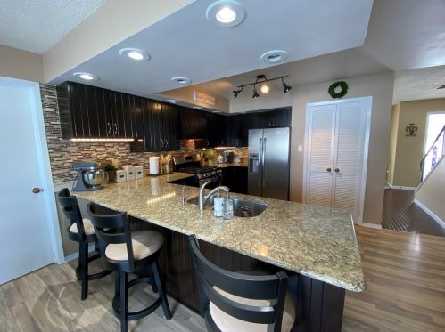

Purchase History
| Date | Event | Price | Source | Agents |
|---|---|---|---|---|
| 03/04/2014 | Sold | $229,000 | Public records | Jodi Myers |
| 02/28/2014 | Sold | $229,000 | Agent Submission | Michelle Arseneau |
Cost estimate history
| Year | Tax | Assessment | Market |
|---|---|---|---|
| 2013 | N/A | $84,458 | N/A |
| 2010 | N/A | N/A | N/A |
Market Activities
Bittersweet Dr Fire Incident History
To date, we have no information about fire incidents in 2025
15 Oct 2017
Fire, other
Property Use —
Street, other
Area of Origin —
Outside area, other
23 Apr 2013
Building fires
Property Use —
Outbuilding or shed
Area of Origin —
Attic: vacant, crawl space above top story, cupola
First Ignition —
Structural component or finish, other
Heat Source —
Arcing
25 Mar 2011
Building fires
Property Use —
1 or 2 family dwelling
Area of Origin —
Common room, den, family room, living room, lounge
First Ignition —
Interior wall covering excluding drapes, etc.
Heat Source —
Spark, ember or flame from operating equipment
08 Nov 2009
Grass fire
Property Use —
Open land or field
Area of Origin —
Open area - outside; included are farmland, field
First Ignition —
Light vegetation - not crop, including grass
Heat Source —
Heat spread from another fire, other
1632 Bittersweet Dr incidents registered in FEMA
(Federal Emergency Management Agency)
To date, we have no information about incidents registered in FEMA in 2025
04 Aug 2008
Power line down
Property Use —
Residential street, road or residential driveway
Bittersweet Dr Incidents registered in FEMA
(Federal Emergency Management Agency)
To date, we have no information about incidents registered in FEMA in 2025
27 Nov 2013
Authorized controlled burning
Property Use —
Residential street, road or residential driveway
13 Jun 2013
Power line down
Property Use —
Residential street, road or residential driveway
05 Jun 2011
Carbon monoxide incident
Property Use —
1 or 2 family dwelling
25 Mar 2011
Building fires
Properties Nearby
| Street Address | Residens/Landlords |
|---|