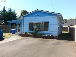
Purchase History
| Date | Event | Price | Source | Agents |
|---|---|---|---|---|
| 05/28/1999 | Sold | $75,000 | Public records | |
| 08/21/1998 | Sold | $75,000 | Public records |
Cost estimate history
| Year | Tax | Assessment | Market |
|---|---|---|---|
| 2014 | $2,089 | $97,930 | $126,600 |
Market Activities
91st Ave Fire Incident History
To date, we have no information about fire incidents in 2025
01 Nov 2019
Outside rubbish fire, other
Property Use —
Residential street, road or residential driveway
Area of Origin —
Highway, parking lot, street: on or near
First Ignition —
Chips, including wood chips
Heat Source —
Cigarette
08 Aug 2019
Outside rubbish fire, other
Property Use —
Multifamily dwellings
Area of Origin —
Highway, parking lot, street: on or near
First Ignition —
Chips, including wood chips
Heat Source —
Cigarette
05 Jul 2019
Outside rubbish fire, other
Property Use —
Multifamily dwellings
Area of Origin —
Open area - outside; included are farmland, field
First Ignition —
Light vegetation - not crop, including grass
Heat Source —
Flame/torch used for lighting
18 Oct 2018
Special outside fire, other
Property Use —
1 or 2 family dwelling
Area of Origin —
Courtyard, patio, porch, terrace
First Ignition —
Fence, pole
Heat Source —
Cigarette
91 Ave Incidents registered in FEMA
(Federal Emergency Management Agency)
To date, we have no information about incidents registered in FEMA in 2025
01 Jul 2014
Power line down
Property Use —
Street, other
26 Nov 2013
Building fires
Property Use —
1 or 2 family dwelling
01 Jun 2011
Heat from short circuit (wiring), defective/worn
Property Use —
1 or 2 family dwelling
25 Apr 2011
Building fires
Property Use —
1 or 2 family dwelling
91 Ave Crime Incidents History
To date, we have no information about crime incidents in 2025
14 Jul 2017
Community Policing
9000 Block 91, Portland OR
Case Number —
171950013
Description —
FOLLOW UP
This data includes requests for police service, not confirmed crimes.
This data includes requests for police service, not confirmed crimes.
Properties Nearby
| Street Address | Residens/Landlords |
|---|