


Market Activities
To date, we have no information about market activities in 2025
Apr 2024
Listed for rent
Mar 2024
Listed for rent
Mar 2024
Listed for rent
Mar 2024
Listed for rent
Apr 2016
Recent Rent
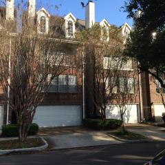
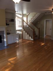
4517 Hazard St
Price history :
- 1790 sqft
- 2 beds
- 2.5 baths
Just 10 blocks from Rice University, and 1.4 miles from the Medical Center. This exquisite...
Apr 2016
Recent Rent
4517 Hazard St
Price history :
- 1790 sqft
- 2 beds
- 2.5 baths
Just 10 blocks from Rice University, and 1.4 miles from the Medical Center. This exquisite...
Apr 2016
Recent Rent
4517 Hazard St
Price history :
- 1790 sqft
- 2 beds
- 2.5 baths
Just 10 blocks from Rice University, and 1.4 miles from the Medical Center. This exquisite...
Apr 2016
Recent Rent
4517 Hazard St
Price history :
- 1790 sqft
- 2 beds
- 2.5 baths
Just 10 blocks from Rice University, and 1.4 miles from the Medical Center. This exquisite...
Hazard St Fire Incident History
To date, we have no information about fire incidents in 2025
26 Feb 2015
Outside rubbish fire, other
Property Use —
Open land or field
Area of Origin —
Other
First Ignition —
Item First Ignited, Other
Heat Source —
Heat source: other
28 Dec 2010
Passenger vehicle fire
Property Use —
Vehicle parking area
Area of Origin —
Engine area, running gear, wheel area
First Ignition —
Item First Ignited, Other
Heat Source —
Heat source: other
16 Aug 2007
Passenger vehicle fire
Property Use —
Vehicle parking area
Area of Origin —
Engine area, running gear, wheel area
First Ignition —
Organic materials, other
Heat Source —
Arcing
27 Mar 2006
Building fires
Property Use —
1 or 2 family dwelling
Area of Origin —
Other
First Ignition —
Item First Ignited, Other
Heat Source —
Arcing
Hazard St Incidents registered in FEMA
(Federal Emergency Management Agency)
To date, we have no information about incidents registered in FEMA in 2025
13 Oct 2015
Gas leak (natural gas or LPG)
Property Use —
1 or 2 family dwelling
08 Oct 2015
Cooking fire, confined to container
Property Use —
1 or 2 family dwelling
30 Nov 2014
Gas leak (natural gas or LPG)
Property Use —
1 or 2 family dwelling
20 Nov 2014
Vehicle accident, general cleanup
Property Use —
Residential street, road or residential driveway
Hazard St Crime Incidents History
To date, we have no information about crime incidents in 2025
07 Feb 2017
Traffic
3700 Block Hazard St, Houston TX
Case Number —
170021152
Description —
Driving Under the Influence
Reporting Agency: Constable Pct 1
Reporting Agency: Constable Pct 1
01 Apr 2016
Property Crime
1600 Block Hazard St, Houston TX
Case Number —
160055694
Description —
Criminal Mischief
Reporting Agency: Constable Pct 1
Reporting Agency: Constable Pct 1
26 Mar 2016
Drugs
2600 Block Hazard St, Houston TX
Case Number —
160048689
Description —
Possession of Synthetic Narcotic
Reporting Agency: Constable Pct 1
Reporting Agency: Constable Pct 1
Properties Nearby
| Street Address | Residens/Landlords |
|---|