
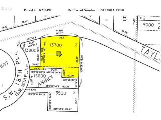
Cost estimate history
| Year | Tax | Assessment | Market |
|---|---|---|---|
| 2014 | $1,267 | $52,860 | $161,250 |
Market Activities
Taylors Ferry Rd Fire Incident History
To date, we have no information about fire incidents in 2025
29 Aug 2019
Special outside fire, other
Property Use —
1 or 2 family dwelling
Area of Origin —
Open area - outside; included are farmland, field
First Ignition —
Heavy vegetation - not crop, including trees
Heat Source —
Heat from powered equipment, other
15 Jun 2016
Dumpster or other outside trash receptacle fire
Property Use —
1 or 2 family dwelling
Area of Origin —
Outside area, other
First Ignition —
Item First Ignited, Other
Heat Source —
Flame/torch used for lighting
30 Jun 2015
Cultivated vegetation, crop fire, other
Property Use —
1 or 2 family dwelling
Area of Origin —
Open area - outside; included are farmland, field
First Ignition —
Chips, including wood chips
Heat Source —
Cigarette
13 Apr 2015
Passenger vehicle fire
Property Use —
Residential street, road or residential driveway
Area of Origin —
Engine area, running gear, wheel area
First Ignition —
Flammable liquid/gas - in/from engine or burner
Heat Source —
Hot or smoldering object, other
Taylors Fry Rd Incidents registered in FEMA
(Federal Emergency Management Agency)
To date, we have no information about incidents registered in FEMA in 2025
01 Sep 2015
Oil or other combustible liquid spill
Property Use —
Residential street, road or residential driveway
30 Dec 2012
Carbon monoxide incident
Property Use —
1 or 2 family dwelling
04 May 2012
Power line down
Property Use —
Street, other
05 Aug 2010
Power line down
Property Use —
Street or road in commercial area
Properties Nearby
| Street Address | Residens/Landlords | |
|---|---|---|
900 Taylors Fry Rd, Portland, OR 97219-4538 Single Family Residential
|
Jake E Council, Merle C Smith | |
920 Taylors Fry Rd, Portland, OR 97219-4538 Single Family Residential
|
Jean Es Web Accessibility, John P Dziennik | |
1480 Taylors Fry Rd, Portland, OR 97219-4276 Single Family Residential
|
Larry Abdullah, Larry E Abell | |
1525 Taylors Fry Rd, Portland, OR 97219-4288 Single Family Residential
|
All Systems Go!, Rod Pera | |
2440 Taylors Fry Rd, Portland, OR 97219-5541 Single Family Residential
|
||
3145 Taylors Fry Rd, Portland, OR 97219-5570 Lot/Land
|
||
7208 Taylors Fry Rd, Portland, OR 97223-1165 Lot/Land
|
Lindsay N Butler | |
7829 Taylors Fry Rd, Portland, OR 97223-9072 Single Family Residential
|
Nicole M Kjos, Michael D Wieck |