Purchase History
| Date | Event | Price | Source | Agents |
|---|---|---|---|---|
| 04/04/2011 | Sold | $48,500 | Public records | |
| 10/08/2008 | Sold | $9,000 | Public records | |
| 06/27/2005 | Sold | $18,000 | Public records | |
| 12/28/2004 | Sold | $18,000 | Public records |
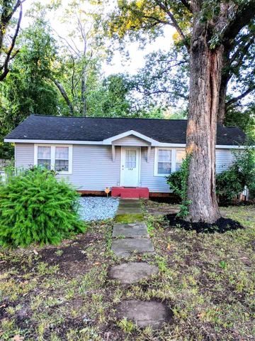
PURCHASE HISTORY 102 Roosevelt Dr, Anderson SC
Cost estimate history
| Year | Tax | Assessment | Market |
|---|---|---|---|
| 2014 | $315 | $1,910 | $47,690 |
Market Activities
Roosevelt Dr Fire Incident History
To date, we have no information about fire incidents in 2025
20 Mar 2019
Outside rubbish, trash or waste fire
Property Use —
1 or 2 family dwelling
Area of Origin —
Outside area, other
First Ignition —
Multiple items first ignited
20 Feb 2019
Fire, other
Property Use —
1 or 2 family dwelling
Area of Origin —
Laundry area, wash house (laundry)
First Ignition —
Wearing apparel not on a person
06 Jan 2019
Grass fire
05 Jul 2018
Trash or rubbish fire, contained
Property Use —
1 or 2 family dwelling
Area of Origin —
Outside area, other
Roosevelt Dr Incidents registered in FEMA
(Federal Emergency Management Agency)
To date, we have no information about incidents registered in FEMA in 2025
23 Mar 2011
Authorized controlled burning
Property Use —
Outside or special property, other
16 Jun 2010
Electrical wiring/equipment problem, other
Property Use —
1 or 2 family dwelling
04 Mar 2007
Vehicle accident, general cleanup
Property Use —
Residential street, road or residential driveway
25 Jun 2006
Authorized controlled burning
Property Use —
Open land or field
Properties Nearby
| Street Address | Residens/Landlords | |
|---|---|---|
110 Roosevelt Dr, Anderson, SC 29624-4529 Single Family Residential
|
Quirie Dennis, Quirie P Dunneback | |
112 Roosevelt Dr, Anderson, SC 29624-4529 Single Family
|
Dorothy Addis, S Stamey | |
113 Roosevelt Dr, Anderson, SC 29624-4528 Unspecified
|
Mildred Jordan, Tommy J Jordan | |
114 Roosevelt Dr, Anderson, SC 29624-4529 Unspecified
|
||
116 Roosevelt Dr, Anderson, SC 29624-4529 Single Family Residential
|
Howard Boles, David M Clinkscales |