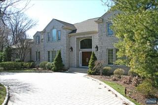

Cost estimate history
| Year | Tax | Assessment | Market |
|---|---|---|---|
| 2014 | N/A | $1,710,400 | N/A |
| 2013 | $41,272 | N/A | N/A |
Market Activities
To date, we have no information about market activities in 2025
Jun 2021
Recent Rent
May 2021
Sold
Apr 2021
Sold
Mar 2021
Sold
Feb 2018
Sold
Sep 2016
Sold
Jul 2016
Sold
May 2016
Sold
Apr 2016
Sold
Mcgrath Dr Fire Incident History
To date, we have no information about fire incidents in 2025
10 Jan 1999
Outside rubbish fire, other
Property Use —
1 or 2 family dwelling
Area of Origin —
Open area - outside; included are farmland, field
First Ignition —
Appliance housing or casing
Heat Source —
Sunlight
Mcgrath Dr Incidents registered in FEMA
(Federal Emergency Management Agency)
To date, we have no information about incidents registered in FEMA in 2025
03 Jan 2014
Carbon monoxide incident
Property Use —
1 or 2 family dwelling
12 Oct 2012
Gas leak (natural gas or LPG)
Property Use —
1 or 2 family dwelling
17 Sep 1999
Water evacuation
Property Use —
1 or 2 family dwelling
21 Apr 1999
Unintentional transmission of alarm, other
Property Use —
1 or 2 family dwelling
Properties Nearby
| Street Address | Residens/Landlords |
|---|